


14 juillet

thle
User
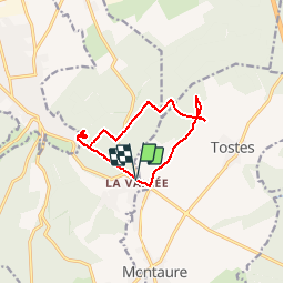

Length
10.1 km

Max alt
138 m

Uphill gradient
181 m
Km-Effort
12.6 km

Min alt
71 m

Downhill gradient
183 m
Boucle
Yes
Creation date :
2014-12-10 00:00:00.0
Updated on :
2014-12-10 00:00:00.0
1h49
Difficulty : Easy

FREE GPS app for hiking
 SityTrail
IGN / Geographical institutes
SityTrail Plus
The world is yours!
About
Trail Equestrian of 10.1 km to be discovered at Normandy, Eure, La Haye-Malherbe. This trail is proposed by thle.
Positioning
Country:
France
Region :
Normandy
Department/Province :
Eure
Municipality :
La Haye-Malherbe
Location:
Unknown
Start:(Dec)
Start:(UTM)
360413 ; 5457427 (31U) N.
Comments